Our Ancient Island – Barrows and Burial Mounds
Discover the Isle of Wight’s ancient history by walking to the various barrows, or burial mounds, that remain here.
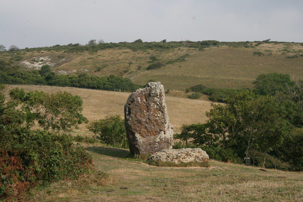
The Longstone
The most impressive ancient monument has to be the Longstone above Mottistone Manor. This site is thought to date from the Neolithic (New Stone Age) era and archaeologists believe that the Longstone was an earthen long barrow (burial mound) with a stone revetted entrance.
The barrow is long gone, having been looted over the centuries, but the two large blocks of local greensand, one upright and the other lying next to it on the ground, are believed to be the remains of the entrance way and are very impressive.
To access the Longstone you can park in Mottistone Manor car park to walk up the signposted footpath (No 43) next to the manor gardens. There is also a small National Trust car park on Strawberry Lane, with signposted walk to the Longstone.
Bronze Age Round Barrows
The Island has over 240 reported sites of bronze age burial mounds known as round barrows, and nearly all of them are on the chalk down that runs through the centre of the island. Some of the mounds have been completely ploughed away and others are covered with trees, but there are a few that can be seen and visited on foot.
These barrows often have large craters in the top of them made by mediaeval grave robbers, nineteenth century excavators and just people walking over them.
The Brook Down Group – Five Barrows
This group is marked as ‘five barrows’ on the 1:50,000 ordnance survey map, but in fact there are eight mounds with three different types of round barrow in the group. Six of the mounds are bowl barrows which are the most common type of round barrow, consisting of a simple mound with or without a ditch. In addition, however, there is one bell barrow and one disc barrow. Access to the site is from the road from Brook to Shalcombe at SZ 395851.
The Mottistone Down Group
These are four visible barrows on the top of the hill, from the National Trust’s Jubilee Car Park at map ref. SZ. 420845. One of these barrows, known as Harboro Barrow, contains the foundations of war-time building.
The Ashey Down Group
There are ten visible barrows, several with central hollows and one mutilated by an army trench. The general area of the barrows are at map reference SZ 571876, via footpath number 24 to Ashey Seamark, however part of the route is not a public right of way.
The Headon Warren Barrow
This round barrow on Headon Warren is one of only a few to survive from the early Bronze Age (1700-1500 BC). It is also unusual in not being sited on chalk. A local chieftain is thought to have been buried here and there is a handy information board next to the barrow.